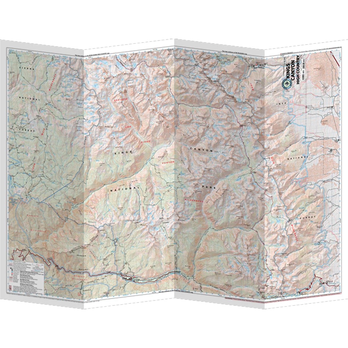
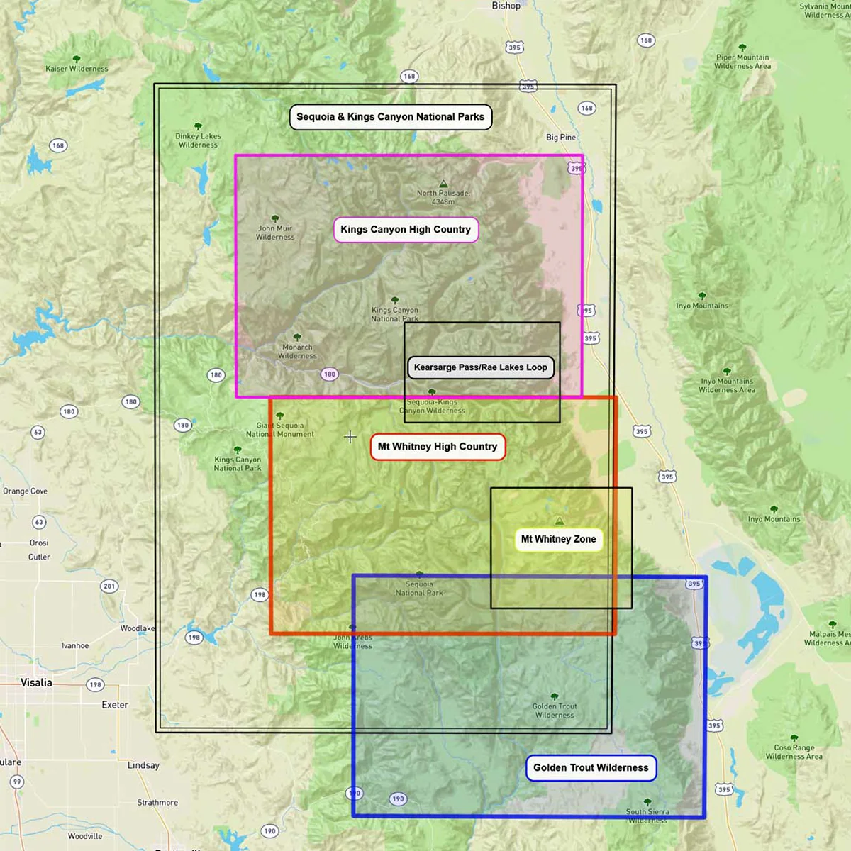
Sequoia - Kings Canyon High Country Map
The Kings Canyon High Country Map covers the national park, along with parts of Sierra and Inyo National Forests. The map offers a very readable scale and excellent detail including trail mileage and elevation points. It shows trailheads, campgrounds, ranger stations, equestrian facilities, bear boxes, forest service roads and more.
- Trail mileage
- Elevation points
- Scale 1:63,360
- 80 ft contours
Original: $10.95
-70%$10.95
$3.28More Images
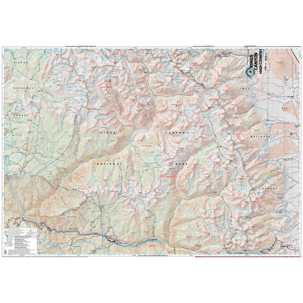
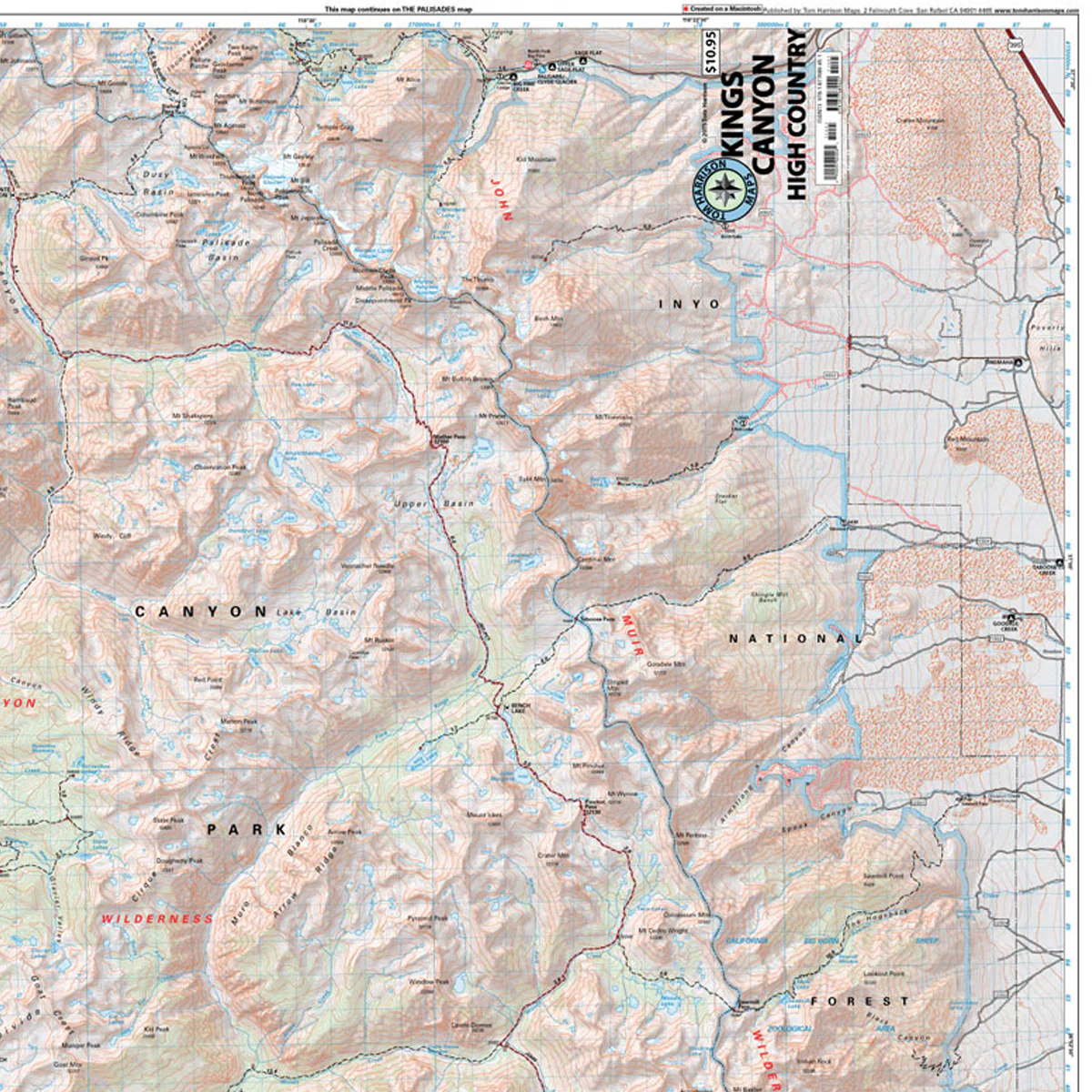
Sequoia - Kings Canyon High Country Map
The Kings Canyon High Country Map covers the national park, along with parts of Sierra and Inyo National Forests. The map offers a very readable scale and excellent detail including trail mileage and elevation points. It shows trailheads, campgrounds, ranger stations, equestrian facilities, bear boxes, forest service roads and more.
- Trail mileage
- Elevation points
- Scale 1:63,360
- 80 ft contours
Product Information
Product Information
Shipping & Returns
Shipping & Returns
Description
The Kings Canyon High Country Map covers the national park, along with parts of Sierra and Inyo National Forests. The map offers a very readable scale and excellent detail including trail mileage and elevation points. It shows trailheads, campgrounds, ranger stations, equestrian facilities, bear boxes, forest service roads and more.
- Trail mileage
- Elevation points
- Scale 1:63,360
- 80 ft contours